
Corpus Christi & the Coastal Bend

Utility Locating in Corpus Christi, TX

Coastal ground behaves differently. High water tables, saline soil, and decades of port and refinery infrastructure make Corpus Christi one of the harder places in Texas to locate accurately, and one of the more expensive places to guess wrong.
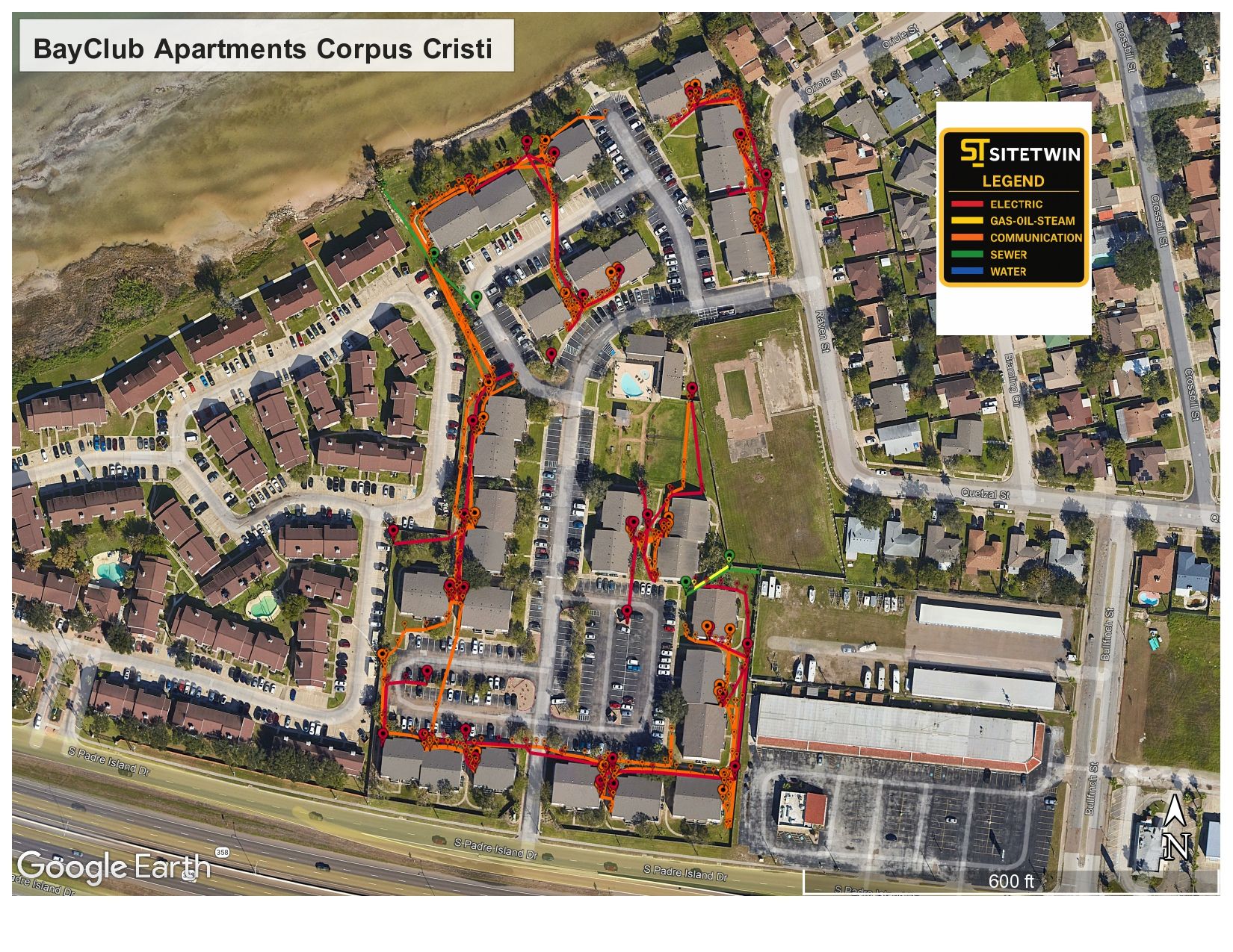
SiteTwin utility map deliverable overlaid on an aerial of a Corpus Christi apartment complex
Mapped in Corpus ChristiBayClub apartments, full site utility map delivered
EM+GPRDual-method locating
PDF/KMZDeliverables included
Same dayTypical mobilization
Same-day or next-day mobilization
PDF maps & KMZ deliverables included
Private utility locating beyond 811 coverage
Coastal Bend Site Conditions

Salt, saturation, and infrastructure built for industry

Saturated and saline soils attenuate radar. Water conducts, salt conducts more, and both pull energy out of a GPR signal before it can return from depth. That is a physical limit, not a technique problem, and it is why coastal work needs electromagnetic locating running alongside radar rather than radar alone.

Corpus Christi also carries industrial infrastructure at a scale most Texas cities do not. Port facilities, refineries, and the utility networks feeding them were built over decades, expanded repeatedly, and documented inconsistently.

  • High water table and saline soils that attenuate GPR signal
  • Port, refinery, and industrial utility networks built in phases
  • Coastal corrosion affecting older buried metallic infrastructure
  • Storm and drainage infrastructure layered over original service
  • Large multi-building properties where 811 coverage stops at the meter
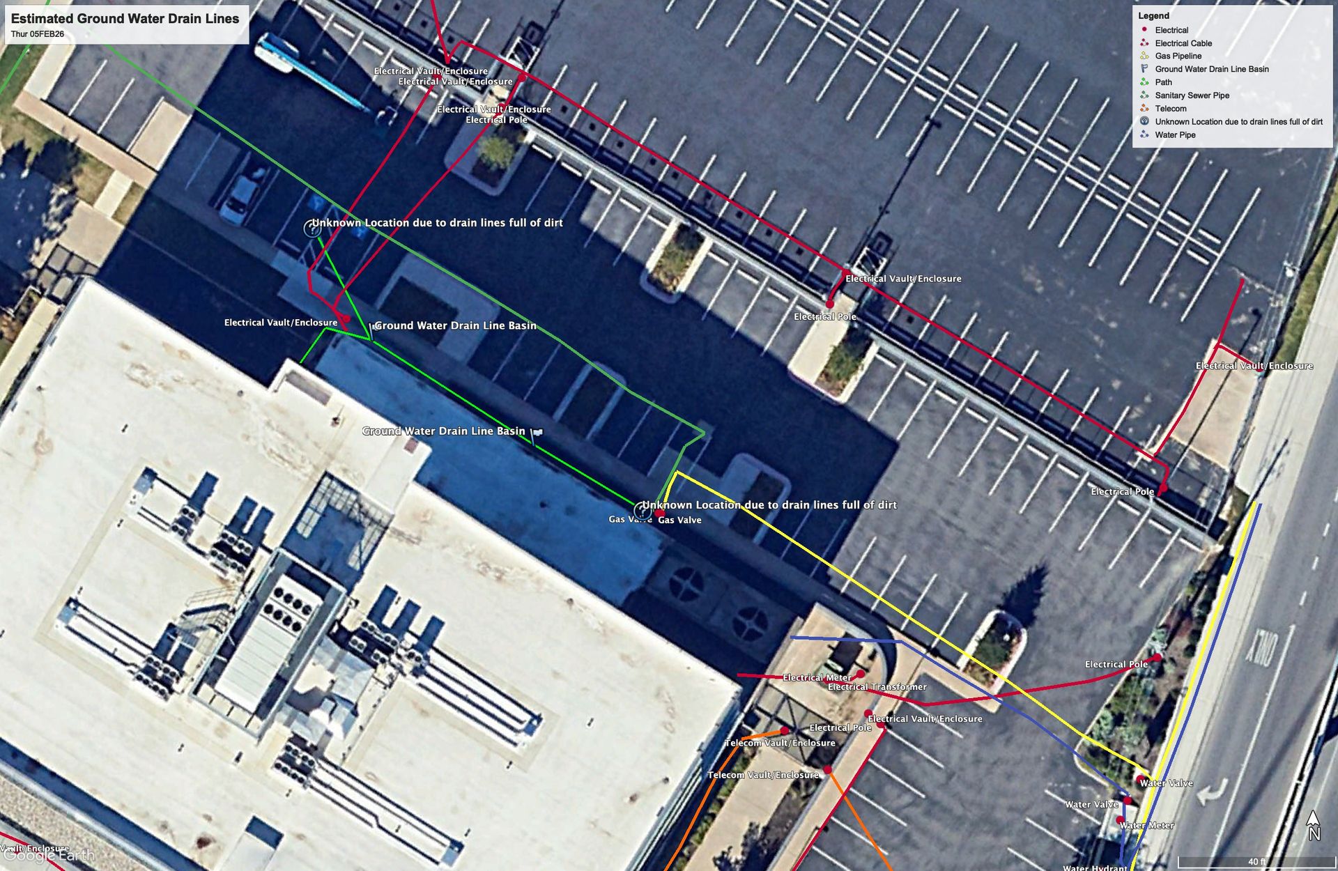
Georeferenced utility map showing color-coded underground lines over a site aerial
What We Do

Services We Provide Across Corpus Christi

Private utility locating, GPR scanning, and concrete scanning for contractors, engineers, and project teams working in Corpus Christi and Nueces County.

Private Utility Locating

Electromagnetic locating and GPR for buried electric, gas, water, sewer, telecom, and unknown lines on private property.

Learn more →

GPR Scanning

Ground penetrating radar for non-metallic lines, abandoned pipe, voids, and utility conflicts EM locating cannot trace.

Learn more →

Concrete Scanning

Rebar, post-tension cable, and embedded conduit located before coring, cutting, or anchoring.

Learn more →
Coastal
Saline soil affects radar penetration
EM+GPR
Dual-method locating
PDF/KMZ
Deliverables included
Multi-Site
Campus and complex mapping
Serving Corpus Christi

Our Corpus Christi service area

Downtown Corpus Christi, the Port, Flour Bluff, Padre Island, Calallen, Annaville, Portland, and Ingleside.

★★★★★

SiteTwin on Google

Contractors and project teams across Texas use SiteTwin for locating and deliverables they can hand straight to the crew.

View Google Profile
SiteTwin Utility Locating
Serving Corpus Christi, TX & Nueces County
Phone: 512-968-5660
Corpus Christi FAQs

Corpus Christi Utility Locating FAQs

Does the high water table affect GPR in Corpus Christi?
Yes, significantly. Saturated and saline soils absorb radar energy and reduce effective depth. This is a physical property of the ground, not a limitation we can equipment our way out of, which is why we run electromagnetic locating alongside GPR and document where coverage was limited.
Have you worked in Corpus Christi before?
Yes. Our project gallery includes a full utility map deliverable for the BayClub apartment complex in Corpus Christi, covering the site with color-coded utility runs and a legend.
Can you locate utilities across a large apartment or campus property?
That is a common scope. Multi-building properties have extensive private distribution past the meter, and 811 does not mark any of it.
Do you work around port and industrial facilities?
Send the site and the access requirements. Industrial and port properties often have their own escort, badging, and safety requirements that affect scheduling more than the locating itself.
Is potholing more important in coastal soil?
It is often more valuable, yes. Where saturated ground limits radar depth confidence, a vacuum excavated test hole is the way to convert an estimate into a measured depth.
What deliverables do I get?
PDF utility maps and KMZ exports are included. For multi-building sites, a georeferenced map is usually the whole point, since it stays useful across phases.

Digging in Corpus Christi?

Send the address and scope. We will come back with a mobilization date and what to expect on site.

Send the Address & Scope
Get in Touch

Schedule utility locating in Corpus Christi

Send the site address and project scope for Corpus Christi and Nueces County. We will confirm scheduling and deliverables before we mobilize.

Corpus Christi, TX & Nueces County coverage
Same-day / next-day mobilization
PDF maps & KMZ exports included